The Wonderland Trail is the pocket-sized epic backpacking adventure. It has all the variety and extremes of a much longer trip -- lush forests, alpine meadows, glaciers, mountain ridges, grueling elevation gains and losses, abundant wildlife -- but you can complete it in just over a week. The 93 mile trail encircling Mt. Rainier is anything but flat. It traverses the many ridges and valleys radiating from the mountain, taking you up a few thousand feet and down a few thousand feet each day. Though I can often see Mt. Rainier from Seattle, spending an entire week in its shadows, seeing it from all angles and elevations, and in all kinds of weather, gave me a new appreciation for its grandeur and mystery. All in all, it made for a pretty amazing week.
September 10 - 17, 2010
Day 1-- Longmire to South Puyallup River (12 miles)
Our grand adventure started out with the very mundane task of dropping off the food cache on the other side of the mountain. I had driven up to the Mt. Rainier Wilderness Information Center in Longmire the day before to get the permit, and was hoping to drop the cache off then, too, but I had to get back home to work.
The Wonderland Trail is strictly permitted, so applications for permits have to be submitted by April of each year, and there’s a lot of hubbub about getting a permit with your preferred camps at your preferred days. We hadn’t decided until July that we wanted to do the Wonderland Trail this summer, so we were doing a less known and less popular method and less exact method known as the walk on permit. Basically, a few spots at each camp are not reserved, but are saved for “walk ons.” Of course there are no guarantees, but when we talked to a Ranger in July, she said that so few people go the walk on route that you can almost always get one. The main caveat, she told us, was that we had to be flexible with our itinerary. Her other two big tips were to go later in the season (after the kids go back to School) and to show up for the walk-on permit early the day before we would start the hike (this is the very earliest you can get a walk on permit).
So, I drove through early mountain mists to the Wilderness Information Center on Thursday morning. I went with no plan – Michael and I were trying to stay wide open since we were advised to be flexible with our plan. We had sort of assumed they would basically give us an itinerary. So, I was surprised when the ranger behind the desk gave me a scarp piece of paper, a pen, and a map, and told me to come up with my ideal itinerary, and we’d take it from there. I went to a table at the back of the Ranger Station and looked at the map. We had talked in passing about taking the trail clockwise from Longmire, as we knew the area east of Longmire was the most developed and least attractive to us, so we would have that section last. We had talked about doing about 10 miles a day, so I looked on the map, and started plotting out 10ish mile sections.
 I should point out that the map the ranger had given me was a paper campground map, and did not have elevations on it. I hadn’t thought to bring mine. Of course, there was a massive 3-D model of the trail and mountain on a giant table behind me, but it seemed too unwieldy and overwhelming to use. I needed the trail right there in from of me. Of course, the campgrounds don’t fall in neat 10-mile sections. So, it would come down to a choice of hiking 8 miles or 12 miles, say, in a day. I tended towards the larger number. It’s so easy to commit to going further in the planning stage! I asked the Ranger about a few longer days where I wanted to make sure that we didn’t commit to doing anything really insane, but he said those days were certainly doable.
Once I finished the plan, he put all my dates and camps into the computer, and hit the return key. (It really was suspenseful.) Everything came back a go, except for Golden Lakes on the second night. Not bad. However, Golden Lakes was one of the worst camps not to get, as the next closest camp was 5 miles either way. So, we ended up with a long first day, and a very long second day. As in an 18-mile day. I guess I was so caught up in actually getting the permit and nearly all the camps that we wanted, that I tried not to think about the beastly second day. (Which in retrospect is probably the worst day to have an extra long day on a long hike.) But in a true pronoia moment, when we dropped the cache off the next day at White River, we asked if any spaces for Saturday night had, perchance, opened up overnight, he said yes. Whew.
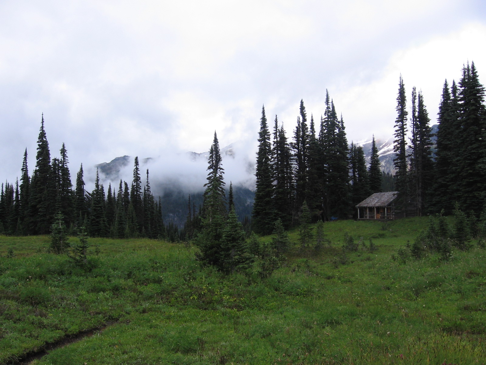
 |
| Indian Henry's Hunting Ground Patrol Cabin |
Anywho, we headed back to Longmire, which took another hour and a half to get back to. We were going to score some lunch vittles at the store/snack bar there, but it turned out to be more of a gift shop with a cooler type thing. So king size Reece’s peanut butter cups and Snickers it was.
When we finally got our packs on and the car locked it was past noon. A couple from Tennessee in the parking lot offered to take our picture. I laugh when I look back at that picture. We look so clean, and so energetic. In our end picture we look weathered and spent.
 |
| Bear! (In the far distance...) |
And then we were really off. We passed another couple not far along – this one from Pennsylvania. They were super nice, out on a long RV tour. The woman warned us about a steep section coming up, and told us to take it slow and easy. Which was funny since, hello, we’re about to hike around one of the biggest mountains in North America. But it was also really sweet, and gave you that kind of motherly care and concern, which is nice to hear right at the beginning of a challenging trip. She said that she preferred day hikes, since she wanted a “tubby” at the end of a long day, which was also kind of funny, because I was already realizing I was going to want my own tubby at the end of this very first day and I was pretty sure there wasn’t going to be one at the South Puyallup River Camp.
And the trail did start getting steeper. My pack was just feeling really heavy, too. I hadn’t walked with my pack this loaded before, and I hadn’t yet eased into the feeling of a heavier pack. I was just feeling uncomfortable and struggling a bit. Still, things had been so hectic lately, it was nice to get outside, and just be able to have a long meandering conversation with Michael. We seem to have some of our best conversations on the trail.
Then, a while later, as I was going up a hill and sweating, I suddenly realized that I felt great. I had got into the elusive zone – that meditative state where your mind is quiet and you find yourself in a place of calm. I was enjoying the exertion.
We passed through Devils Dream at 4:00, and got our first taste of what I termed the Wonderland Exchange. Every time you pass someone with a big pack, there’s generally and exchange about where you came from, where you are going, and what day you are on. Of course, it’s all sort of irrelevant, a sort of small talk, but it’s nice. It’s like we were all removed from the outer world, but we had our own world here, our own natural beltway around this mountain, and we were our own community. But sometimes these exchanges were immensely helpful. Occasionally you would get a tip about a worthy side trip or a bear sighting, or a warning about a tricky part of the trail.
 |
| Suspension Bridge across Tahoma Creek |
Just a little further along, the trail suddenly opened up to alpine meadows. This was the area know as Indian Henry’s Hunting Grounds. There was an old log patrol cabin that looked to be in pretty good shape fro the outside. And then Michael spotted a bear was way off across the meadow to the left. (There is a reason he is nicknamed Hawkeye!) We stopped and looked at the bear for a while, and he looked at us. Then he meandered on his way and we meandered on our way. I had never seen a bear in the wild before and I have to say, between the glistening flowers and the wide-open meadow, it was pretty incredible.
Just past Indian Henrys, we got our first glimpse of Rainier, peeking in and out of the drifting clouds. We were getting really excited, thinking about what the rest of the trip might bring.
 We felt like we were making good time, but when we got to Tahoma Creek Trial, it was 6:15 and we still had 3.8 miles to go. We realized we were screwed and that we had to pick up our pace. This also where the trail started to go steeply up. Our blissful walk had suddenly become the Bhatan Death March.
The trail got steeper and rockier. To the east of the trail, towards the mountain, we looked out a wasteland of gravel mounds.
It started getting dark.
It’s always a bad feeling to still be on a trail (unintentionally) when the sun starts to go down. We knew we had gotten a late start, but hadn’t thought we would be running this far behind. We got out the headlamps. It seemed to take forever to get to camp, since we had to go slower because of the rocky and now dark trail.
We got into camp about 11:00. We were trying to quietly go through camp, but we startled someone with our headlights. He popped out of his tent and said, “Who’s there?” Apparently, it is good camp etiquette to alert someone to your presence if their light is on. Lesson learned. Luckily, the tent sites were far apart at camp, so we were able to set up our tent, cook dinner, and do our bear hand without disturbing anyone else.
Day 2 South Puyallup River to Golden Lakes (12.5 miles)
 The first unpleasant discovery we made this morning was that we suffered a chipmunk attack in the night. We had bee worried about the possibility of rodents when we decided to use a bag instead of a bear canister, but we opted for the lower weight. Besides, we hadn’t heard too much about rodent issues. Luckily it wasn’t an extreme attack. Just some trail mix – but a surprisingly large amount. Critters are scrappy – they always figure out a way to get what they want. On an overnight trip, I had a friend who lost all of her peanut butter power bars, but no other flavor was eaten.
Though we had vowed to get an earlier start, after our long day yesterday we were tired. We slept in a little, and then sort of lollygagged and putzed around camp. By the time we had pumped water and got our packs on it was already 11:45!
 The trail started going steeply uphill right away. Switchbacks are a rude awakening first thing in the morning, even if your morning is starting closer to afternoon. I was reminded of what some women hikers had told us the day before as we were talking about the intense ups and downs of the trail: “That’s why they call it a pie crust.” Except a piecrust has a lot of little ups and downs. Wonderland has big ups and long downs. And every time I thought about the piecrust theory, I thought about how good a cherry pie would taste. With some vanilla ice cream on the side.
I was dragging today, for sure. My heels were really bothering me, so I took off my boots when we stopped to take a break. That’s when I made my second unpleasant discovery of the day. I had blisters.
Now, while I am no master hiker, I have been doing this for a number of years, and I like to think I know a lot about the golden rule of hiking: “Don’t get blisters.” My boots fit well and had been broken in over a number of months. The day before, when I had felt the dreaded “hot spots,” the precursors of blisters, I had stopped and put some duck tape on them to keep the skin from rubbing. The night before, I had noticed a little redness, but it seemed that the blisters were going to pass me by. But now, sitting on the side of the trail with my socks and boots off, there was no denying that I had a major blister. A big one. Once you get a blister you’re sort of screwed, but we had bought some spiffy blister cushion type bandages, so I patched my foot up as best I could, and we kept on moving.

 |
| Golden Lakes Ranger Caption |
We passed a group of guys moving incredibly fast, with hardly any gear. One guy in the group said they had started the trail the day before, and another guy in the group said that they were finishing the trail the next day. After talking to them some more, I finally realized that they were on an ultra light trek around the mountain, basically covering about 30 miles a day. Only one guy had a sleeping bag; another had an emergency bad that he had put a hand warmer in. They had spent one night in one of the park-run lodges, but another night there was no room so they had been pretty cold. They were walking with a definite sense of urgency. They kept breaking off from each other, then regrouping, then stopping to look at the views, then quickly hurrying off.
Later, we passed a couple guys with large packs, deep in conversation, walking at a steady but slower pace. It turned out that they were doing it in 13 days. It occurred to me that the old adage from marathons, “run your own race” could definitely apply to hiking, and especially the Wonderland Trail. You could definitely adapt your hike to be whatever you wanted it to be – be it a 3 day ultra light challenge, or a 2 week escape from civilization with a good friend. I remember reading about a family with 6 kids that had done the trail, which I still think is amazing. But the ability to set your own mileage, and to use the food caches allows you a lot of flexibility to cater to your needs.
 |
| Golden Lakes Campsite |
I checked my bandages again when I got to North Puyallup and the bandages were slipping. Not good. The last 3.9 miles felt incredibly long to me that day -- .5 of flat, 2.5 miles of long steady uphill, and then .9 miles more of flat. Much of the day’s hike was on soft pine needles, which was nice, but my feet hurt, and I was glad to get to camp. Golden Lakes was a really beautiful spot for camp – there was an old patrol cabin there, the lakes of course, and the camp sites were sort of up on these bluffs that with incredible views through the trees.
We pumped water from the lake as the sun set. I was definitely not in the zone today.
Day 3 Golden Lakes to Mowich Lake (9.2 miles)
 |
| Mountain Bog Gentian |
I discovered how charming the Golden Lakes outhouse was the next morning, when it was light enough for me to red the welcome message the rangers there had posted, along with a photo and description of a late summer alpine meadow flower – the Mountain Bog Gentian. When you’re away from creature comforts, little things like that are so nice and welcoming. And, we actually saw several Mountain Bog Gentian over the next couple days, so it was fun to be able to identify them.
Even though the alarm clock didn’t go off until 10:24, we moved quickly and managed to get a decent start. Even though we weren’t getting out quite as early as we wanted to each morning, we were really tired and we were getting out a little earlier each day.
We saw a guy coming in the opposite direction right after we left camp. He said some people had seen bears in the area the day before – apparently a mother bear with cubs had reared up as a warning to the hikers.
 We found ourselves hiking through beautiful country – mountain bogs leading into lush forests, all on a pine needle-cushioned trail. There was 2 miles of flat, 3 miles of down, and then, after we crossed a couple rivers we walked by the South Mowich River Camp. We met a couple coming in the opposite direction, and as we did the normal Wonderland exchange they started asking us if we were going to take the Wonderland Trail or Spray Park Trail. After Mowich Lake (where we would camp that night), you can either continue on the Wonderland Trail, or you can take a slightly shorter, but much more strenuous route through Spray Park, and meet back up with the Wonderland Trail. We had intended to just stay on the Wonderland, but this couple waxed on about the snowfields, rainbow, rolling fogs, and bears in Spray Park. This type of encounter is one of my favorite parts about traveling – how you start planning your destinations based on your talks with other people and instinct, and rely less on the cerebral guidebooks and maps method. The trip starts to take on a life of its own. I am so grateful that we ran into them, because we did end up doing Spray Park, and it turned out to be the highlight of the trip.
 We took a lunch break, and pulled out the map. While we had realized we could finish the trail in 9 days if we wanted to add a couple of extra miles to the last day, we then realized we could finish in 8 days by doing a 13 miles on the last day. While we weren’t interested in rushing the trip, finishing in 8 days would give us a rare weekend together after finishing the trail. We decided to wait and see how we felt, but the idea of a weekend together at home before returning to work was enticing.
 |
| Mowich Lake |
After South Mowich River Camp, it was up, up, up about 2,000 feet on long switchbacks through the forested side of a ridge to Mowich Lake Camp. Just as we were approaching camp, we ran into a family of five. The father was really interested in the fact that we were doing the entire Wonderland, and said that he’d love to do it sometime. That made me realize how lucky we were to be able to do this now, and glad that we had managed it even though it was tough to take the time off work. Michael mentioned that we had read about a family with 6 kids who had done it, but he (and his wife) were not down with that idea.
 |
| Camp Carpark: Mowich Lake Campground |
Mowich Lake turned out to be a big disappointment. Big disappointment. Basically it was a huge gravel parking lot, with tent sites marked off with wood squares throughout the parking lot. And next to this were an outhouse and an actual parking lot full of cars. We spent a good half hour looking around the area, sure that there was a more private and natural campground around that we were missing, but no, that was it. Mowich Lake was beautiful – there were these fuzzy black and white birds flying all around and the sun was starting to set. A bunch of mountain climbers came of the trail one by one looking spent, and got in their cars and drive away. But, it’s incredibly discouraging to hike 35 miles to get to a parking lot. We decided to make the best of it and used a picnic table to get organized for the next day, and to make and eat our dinner. Luckily, we were the only ones in the camp, so the lack of privacy wasn’t much of an issue. The sky was incredibly clear that night (I was starting to get used to seeing a plethora of bright stars every night), and it was incredibly cold – probably the coldest night on the entire trail.
Day 4: Mowich Lake to Mystic Lake (13.2 miles)
 |
| Eagle's Roost |
We had decided to do the Spray Park route, so we knew we had a grueling day ahead of us – 1500 feet up through Spray Park, 3,000 feet down to the Carbon River Suspension Bridge, and 3,000 feet up to Mystic Lake, our reserved camp for the night. We got up at 6:30 and packed up camp in the freezing cold. I didn’t take my down jacket off until the very last minute, and I kept my gloves on.
We started out on a level forest trail, but it started climbing pretty early. Soon, our effort was repaid by some amazing views of Rainier at Eagle’s Roost – a viewpoint just off the trail. The sun was just rising behind the mountain and the view was unbelievable. We snapped a bunch of pictures.
 |
| Spray Park |
We had a perfect day for Spray Park – clear and sunny. There was lots of up to get into Spray Park – lots of rock “steps.” We eventually came out into the gorgeous alpine meadows that are Spray Park. The area has a surreal beauty – colorful flowering meadows, dotted by evergreen trees, surrounded by mountains, and, of course, the mighty Mount Rainier. And Mt. Rainier kept getting bigger and bigger. The high point on the trail was marked at 6400 feet, where we stopped for a break and marveled at the mountain. Looking at Rainier is like looking at a fire or waterfall – you can just stare at it without fully comprehending it. We see the mountain often enough from Seattle, but to be here now, looking right up at its crevasses was incredible.
But we still had a long day ahead for us, so we couldn’t linger too long. So, we sadly left Spray Park and began our 3,000 foot decent. Much of this decent was over huge rocks, which was hard on my already damaged feet in every way possible – toes slamming into the front of my boots as I stepped down, heels rubbing on the back of the boots as I picked up my feet, and just a hard general pounding on the bottom of my feet. The mountain views were wonderfully distracting.
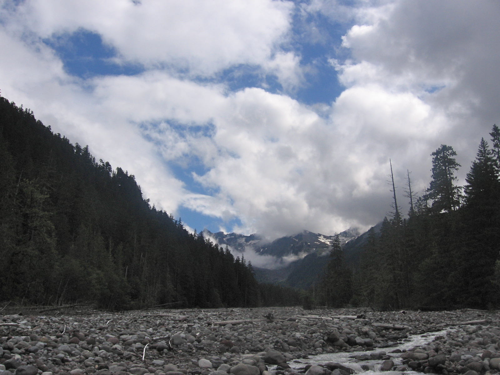
Eventually we made it down to Carbon River and crossed the suspension bridge there. As we reconnected with the Wonderland trail, we hiked up a rocky, dusty path along the Carbon River – and along Carbon Glacier. I had never seen a glacier up close before, and had expected a pristine white hunk of ice, like you see in Antarctica documentaries or cartoons. But this glacier was a slate gray (perhaps leading to the name Carbon?) covered in gravel and rocks. There were sign all over warning about the dangers of climbing on the ever-changing glacier. And we kept hearing rocks tumble down the glacier in different parts as we walked alongside it. The river seemed to go through and under the glacier.
 |
| Map Check |
We were on the long gradual but steady uphill for sure. But I actually enjoyed this part. I was having one of the most incredible backpacking days of my life and I was in my Zen place.
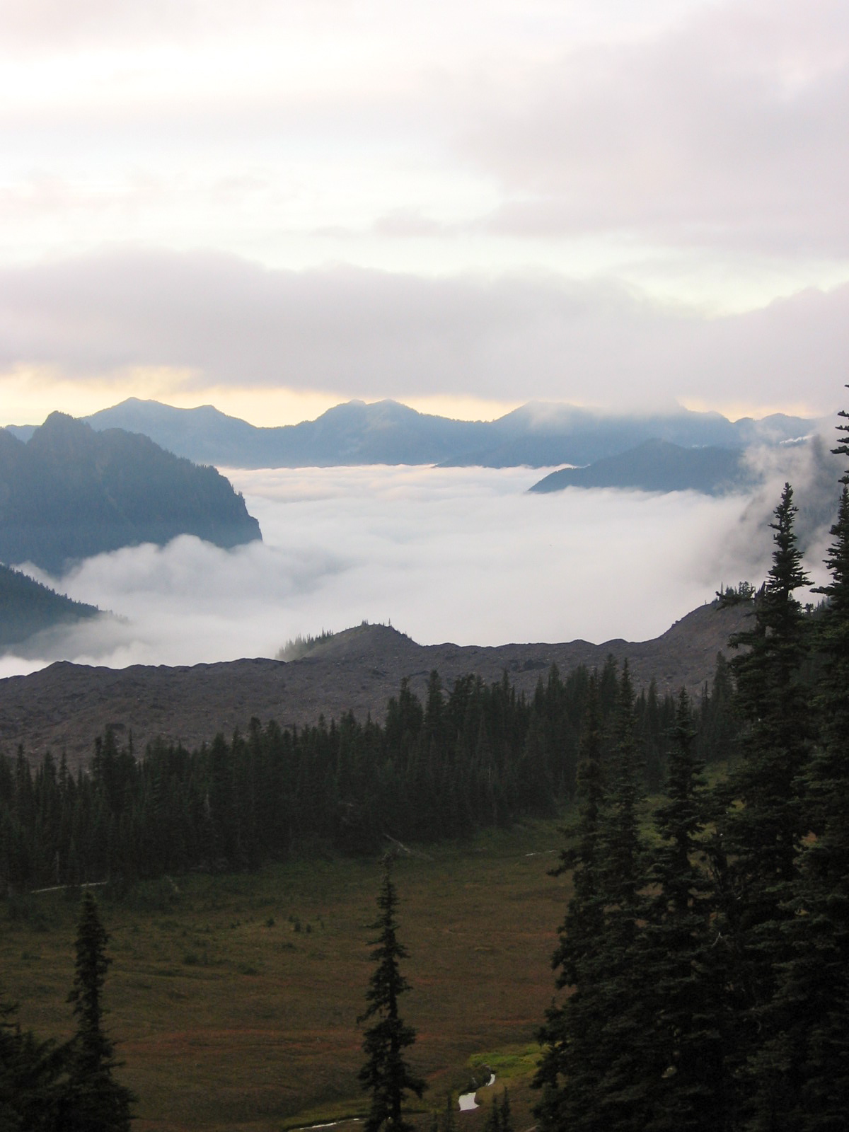
We came to a flat section with a stunning meadow with these beautiful deep red swaths of color. Then the trail continued up. As we looked back, we could see the clouds lying in layers over the meadow and mountains. We were moving forward, but we couldn’t stop ourselves from looking back. The sun was just starting to go down, and we were looking forward to getting to camp in the next mile or so.
 The trail became more wooded, and then, as I rounded a corner I saw a huge bear right in from of me on the trail. I doubled back around the bend and told Michael in a whisper, “There’s a bear.” Michael peeked around the corner and saw it too. Now, I should preface this by saying despite my love of backpacking, I have always had a sort of fear of bears. I especially feared one day surprising one on the trail, much in the scenario we just found ourselves. But, seeing the bear in real life didn’t seem scary at all. Exciting, absolutely, but not frightening.
 Since the bear was in the middle of the trail, munching on blueberries along the trail’s edge, and there was no way for us to go around it, we started talking to it in low voices, trying to get it to move on. Michael, ever respectful, said, “Hey bear, I know this is your forest and your dinner and you have a right to be here, but if you could move along, we would be very grateful.” You start to feel kind of silly talking to a bear. And we really did say, “Hey there, bear…”
The bear couldn’t have cared less. He didn’t look at us, didn’t turn his head, didn’t so much as bat an eyelash. He just kept on munching berries. Did I mention there was no way to get around him? And it was getting dark? And camp was only a mile away? But the bear was large and in charge, so all we could do was make our requests, and wait. After what seemed like a long while, the bear carried on heading (thankfully!) away from us.
 As we were walking away down the path I said, “Was it just me, or was that bear really big?”
“That bear was huge!” Michael said. “He had grey in his coat – I think he was an old timer.”
We talked about the bear the entire rest of the way to camp. I understand now why people who see a bear usually describe it as the highlight of their trip. It is really exciting to see a wild animal – especially a big one – up close in its natural habitat. It was exhilarating to see the least. And seeing a real bear up close pretty much dispelled my irrational fear of bears. I now sleep like a baby when I’m camping out.
 We hiked on by Mystic Lake, which was beautiful in the setting sun. We kept expecting the camp any minute, but it turns out the Mystic Lake Camp is on the other side of the lake, so we hiked as quickly as we could to try to beat the dark.
We got to camp at the very last few minutes of dusk. We talked to a couple camping right near the entrance to camp, and then looked for a space of our own. A ranger was actually in camp, so Michael talked to him for a while, and he checked our permit. (We noticed that rangers were very diligent about checking permits in the park.) The camp was full. It was also quiet, and all the tent sites were close together, so we tried to quietly set up our tent and cook dinner. Everyone’s lights went out while we were eating. We made this Thai curry instant soup, and man, did hot soup taste good! It was probably my favorite meal of the week, but it might have just been that I was so incredible tired and cold that the soup hit the mark. We slept very well.
Day 5: Mystic Lake to White River (12.3 miles)
 We set our alarm for 6:30, but it was so cold and so quiet that we snoozed a little. We had to pump water. Pumping water became the dreaded task of the trip. When we got into camp at a decent hour, we’d pump at night, and we wouldn’t have del with it the next morning. Having to pump water in the morning just made it seem like we had so much to do before we could hit the trail. We decided to make the task a little more palatable by going down to the creek together to pump water. Having wet hands made it feel even cooler. We ended up talking to a bunch of the other people in camp as they came down to pump water. We also admired all the filters that were faster than ours.
 |
| marmot |
We ran into a few more folks as we were leaving camp and with all the talking and prepping, it was 9:30 by the time we were on the trail. It was a pleasant hike for the first mile or so and then it was up, up, up. At first the switchbacks were fairly flat, but then they became dramatic. We had to stop so we could strip down to shirtsleeves.
We got some great views of Rainier and a Winthrop Glacier as we came through the pass. Rainier continued to beguile me – every view we got was from a slightly different angle, and gave a completely impression of the mountain.
 Eventually the trail leveled out into a huge open meadow that reminded me of Switzerland. 5 different trails intersect near Frozen Lake, so there were suddenly lots of people around.
This was when I experienced a low point of the trip. Though the terrain wasn’t difficult, for some reason my feet were really hurting me. And, I needed to go to the bathroom, but in the huge open beautiful meadow filled with hikers I couldn’t find any tree cover.
A couple of beautiful women in mountaineering gear (very cool purple gaiters I had never seen before!) passed us and told us that there was a huge herd of goats just over the ridge, and that they may come our way. I remember thinking, “I don’t give a damn about a bunch of goats – I need to pee and my feet hurt.” Yeah.
 |
Glacier bordering Mt. Rainier
|
Finally, I found this ridiculously small clump of evergreen trees. I decided to go for it and dropped my pack.
Unfortunately, once I got in the said clump of trees, I realized there wasn’t much cover at all, and since the trees were in close view of two trails, it was hard to find a place to squat where the entire happy hiker countryside wouldn’t have a clear view of my backside. I figured once the couple walking down the path passed by, I would have my window of opportunity. But just as they were passing, they started talking to Michael. And my chatty husband proceeded to have a long conversation for them. I curse him, I cursed them, I cursed the entire gorgeous mountain meadow. Then I got on all fours and slithered under some low branched to get under a huge tree that would give me more cover.
After that, I decided to sit my cranky self down to fix my blister bandages yet again, drink some water, and just take a break. I felt much better, and probably should have done that a while ago.
 We hiked on towards Sunrise, which was pretty flat. After Sunrise, the trail headed down dramatically for 2,000 feet. The last 2.2 miles of switchbacks into White River Amps seemed to take forever. My feet were throbbing, and I kept expecting camp to appear at any moment, but we kept descending.
We finally made it to the camp. White River is actually a huge car camping compound. There is a small section at the bottom of the trial that is reserved for Wonderland hikers, but it isn’t anything special. Still, the camp had lots of trees, so was much better than Mowich Lake, and it had running water, so we got a break from pumping.
There was a very special surprise waiting for us at White River – our food cache. We gimped our way down to the Ranger Station, and got some pictures of me opening up the huge cache locker. We started sorting through the buckets, looking for ours, but no go. Our cache wasn’t there.
 We walked back around the front of the Ranger Station. It was locked, but we looked into the office through the glass door, and we could actually see our cache – with our name on it – sitting just inside the locked door. So close, but so far.
Luckily, there was the emergency phone just next to the Ranger Station. I hadn’t seen another phone on the whole trip, so as much as the absence our cache available could be seen as unlucky, the presence of the phone was very lucky. Michael made the call, and we were told Ranger Eugene was on his way.
We sat our tired, hungry, stiff selves down on the curb and waited. It was a good thing that we had got to camp as early as we did, because otherwise I don’t know that we would have gotten hold of anyone on the phone. And as we were down to the bottom of the barrel on food, that could have been ugly.
 After a half hour or so, a Ranger showed up, unlocked the Ranger Station, and got our cache. He was really adamant about seeing our permit though, which was back at camp, so he put our cache in his truck and he met us back at our campsite. We presented our permit and got our cache. I double-checked our bucket, which was indeed marked with the correct date, so I’m not sure why our cache wasn’t in the right spot. The Ranger didn’t present any explanation, and I didn’t ask. I was just happy to get our food. And rangers
carry guns. I’m sure they have bigger issues to deal with than a couple hikers’ food resupply. Did I mention we had stashed some Pringles in our cache? Oh, happy day. The campsite was half empty, and the designated Wonderland spots didn’t have picnic tables, so we moved to an adjoining campsite, spread our food out over the picnic table, and had us a feast.
After a half hour or so, a Ranger showed up, unlocked the Ranger Station, and got our cache. He was really adamant about seeing our permit though, which was back at camp, so he put our cache in his truck and he met us back at our campsite. We presented our permit and got our cache. I double-checked our bucket, which was indeed marked with the correct date, so I’m not sure why our cache wasn’t in the right spot. The Ranger didn’t present any explanation, and I didn’t ask. I was just happy to get our food. And rangers
carry guns. I’m sure they have bigger issues to deal with than a couple hikers’ food resupply. Did I mention we had stashed some Pringles in our cache? Oh, happy day. The campsite was half empty, and the designated Wonderland spots didn’t have picnic tables, so we moved to an adjoining campsite, spread our food out over the picnic table, and had us a feast.
 |
| Cache! |
In fact, we had too much food. We used the picnic table to organize all our food, and looking at it all spread out, we were not looking forward to putting it all on our backs in the morning. Since we were planning on finishing the trail a day or two early, we had at least one, and likely two extra days worth of food. We contemplated leaving some of it behind (there is an extra food container in every cache chest), but the truth is, we knew we would use all the food on another trip or at home. We ended up just keeping it all.
I washed my face in running water in the bathroom by the light of my headlamp, which was a treat, and we went to bed not long after the sun went down.
Day 6: White River to Indian Bar (11.3 miles)
 We got caught up talking to some people in camp the next morning (we decided this is part of the experience!) and made it out of camp at 10:00. The first 3 miles were very level and very smooth, and we made great time. The next three miles, leading up to Summerland, were uphill. We passed lots of day hikers. There was a group of elderly people out for a hike, which I always love to see. An older gentleman on his way down told us it was about 45 minutes to the top, “But I’m slow,” he said. When we told him it’s all uphill, he said, “Well, that’s the way it is.” Wise words.
Just as we were coming into Summerland, which is 5900 feet, it started getting really windy and rainy. Luckily, there was a shelter there, so we ducked in to escape the wind and rain. There were already two people in the shelter – a really cool local couple who generously offered us their food and wine and anything else we might need. We declined on the wine, trying not to get too relaxed since we still had a ways to go, but we would have loved to hung out and drunk wine with them for long while. We spent an hour or so talking with them, and as the storm had stopped, we headed on.
 |
| Panhandle Gap |
As we were leaving Summerland, we met two guys pumping water at the creek. They had passed us earlier, and we remembered them because they were traveling ultra light, with really minimal lightweight backpacks and trail runners. They were taking about 8 days to do the trail – they had cached a lot of food, and were going to “blaze out” 20 miles on the last day from Indian Bar to Longmire. We spent a while getting their tips on lightweight gear and the wand style water purifiers they had. They did the trail every year, so they really had it down to a science. We also talked about the trail “stink” we developed after a few days. They had swum in Mowich Lake on day 4. I was kind of disappointed that we didn’t get any swimming in yet on the trip – it had just never been that warm when we were in camp in the morning and evening.
So, we headed out from Summerland, and just as we got up to Panhandle Gap, the highest point of the entire trail at 6800 feet, it started storming. This was literally the worst place on the entire trail for us to be when a storm hit. It was rocky and barren with no cover. As we passed between various rocky outcroppings it got windier. There were some powerful wind gusts, and it suddenly felt brutally cold. We stopped to put on our rain jackets. They flapped in the wind as we struggled to get our arms in, and we had to cinch down our rain hats so they didn’t blow off.
As we started walking again, it started to hail. Hail being blown by the wind hurts. So, I walked with the brim of my hat pulled down low over my face. I had contemplated whether I really needed a rain hat and I have to say, that was one worthwhile investment. Walking through the large swaths of snow against the wind was exhausting. There were also ponds around us, and one in particular was the color of the Caribbean Sea.
I should say, we were fully enjoying the storm. Though cold, it was exhilarating and fun. It felt like a real adventure. Finally, we came out of the gap and the trail started going down. We had 1800 feet to go down before we got to camp, and it was raining steadily. My feet were getting soaked. We wished we had brought gaiters. We had packed all of our clothes in ziplock bags, but my sleeping bag was not in a bag. Michael did a bag check and said my sleeping bag compartment wasn’t getting wet, so we didn’t stop to bag it.
 |
| Indian Bar Shelter |
It seemed like forever that we were walking down the trail. It gets to the point where you start expecting to see the camp any minute, and that makes it seem so much further. At last we saw the Indian Bar shelter in the distance, and it was a welcome sight. I have a new appreciation for the term “shelter in the storm.”
We dropped our packs in the shelter, used the toilet, and checked out the camp, which was actually across the creek from the shelter. We figured we would offer to share the shelter with any other waterlogged campers. But no one was there. We hadn’t seen anyone since we left Summerland and we felt like we were completely alone in a rainy landscape.
 |
| View from Indian Bar Shelter |
We cooked dinner, discovering a lot of little mice friends in the process. We decided to set up the tent in the shelter, just for the sake of warmth and to avoid having little critters running over us in our sleep. We got into dry clothes and set up a clothesline to try to dry our all our wet clothes. I also discovered that my sleeping bag had gotten wet. I should have just kept it in a garbage bag. Rookie mistake. Luckily, it wasn’t too cold that night, so Michael and I just cozied up under his bag.
In an act of true generosity, Michael offered to do the bear hang. I was starting to feel pretty swell in my dry clothes and leaving my newfound shelter was the last thing I wanted to do. We also strategized on our plan for the next day. We decided if we woke up and the weather was nice, we would hike to Nickel Creek, per the original plan. But if it were raining, we would do a marathon 20-mile hike out the next day to avoid another wet night.
Day 7: Indian Bar to Longmire (20 miles)
 We set the alarm for 6:00 to see if the weather had let up. We knew that if the weather was still bad, we would have a very long day ahead of us and would need to get an early start. It was still raining. So we did probably the quickest pack up of the trip, skipping our usual oatmeal in favor of some energy bars. Damp clothes went back in the packs, including my new wool base layer top, which now had mouse bites in it. Grrr.
The trail immediately went up hill – steeply uphill. I had psyched myself up for the day, but the immediate and dramatic uphill first thing in the morning was brutal. But pretty soon we came out along a ridge. There were no views since it was rainy and overcast, but it was a beautiful morning. Not having views made me notice the things close to me – the gorgeous birds (pheasant or quail?) singing in the bushes, the sound of the rain hitting the leaves, the vibrant greens all around us.

 After about 5 miles we came to the junction with Cowlitz Divide Trail and ran into 3 people from the maintenance crew. They had been doing some work up the trail a few miles, but they were jumping ship because of the rain. After a couple minutes 3 young backpackers came up. They were just starting the Wonderland, and were headed to Summerland for the night. I hate to say it, but the rest of us didn’t give them much support. One of the maintenance guys said, “I’m glad I’m not headed up to Summerland in this.”
“Maybe it will clear up and the rest of your trip will be great,” I offered hopefully. But they said the weather report was calling for rain the next three days. We left them with a dubious “Good luck.”
 The boss of the trail maintenance crew had been working at Mt. Rainier for 33 years. We walked with him for a few miles. It was fascinating to hear about Rainier from his perspective. I also never thought about just how much goes into trail maintenance – all of the complex bridge structures and logistical issues that have to be tackled without harming the natural environment. This man probably knew the mountain better than anyone out there. Talking with him was a pleasant distraction from the miles we had yet to go, and he kept us moving fast (those maintenance crews are in awesome shape!).
 20 miles out with a fully loaded pack is pretty brutal, but I got through it by separating the distance mentally into 5 miles pieces. When we got to Maple Creek I knew that was just over 10 miles down – over halfway. But about this point the trail started going up along the river. This was Steven’s Canyon – 4 very long miles of narrow, rocky, steady uphill. We were starting to get really tired at this point. We would get hot and take our rain jackets off, and then it would start raining again and we would get cold and put back on our rain jackets.
Eventually, and thankfully, we came out of the canyon and started to go down. We passed by a series of gorgeous lakes – Louise Lakes and Reflection Lakes being the largest – and we ran into the pair of lightweight hikers we had met just the day before. They had decided to hike all the way out form Summerland – 24 miles – to avoid another wet night.
 My feet were throbbing by this point. We had put our feet in plastic bags inside our shoes to keep them dry, but as it had rained most of the day, the bags – and our feet – were holding water in, instead of keeping it out. At least the water logged bags provided squishy cushioning for my blisters, so those didn’t hurt so much. It was just my feet in general hurting from walking on them for so many miles. We were too tired to take the bags off, and at this point it didn’t really matter. We just had to finish. There were a lot of self pep talks and partner pep talks at this point, and it took a lot of fortitude to keep going. Usually at the end of a backpacking trip I think a lot about real, fresh, hot food, but this time all I was thinking about was taking my boots off, taking off my wet clothes, and getting a hot shower.
 |
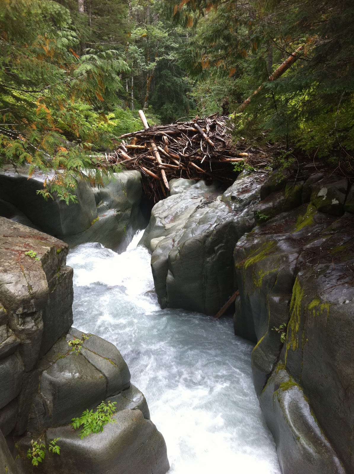
| Steven's Canyon |
The last several miles were the easiest and flattest of the entire trail, but they were also the most challenging. A few times I stopped to rest my feet for a few minutes and felt like crying, my feet hurt so bad. I had to go deep. We were close, and as the sun started to go down, we walked as fast as we could. We wanted to make it out before we had to put our headlamps on, and we finished the trail about 8:00, just as the sun was setting.
 January 23, 2011
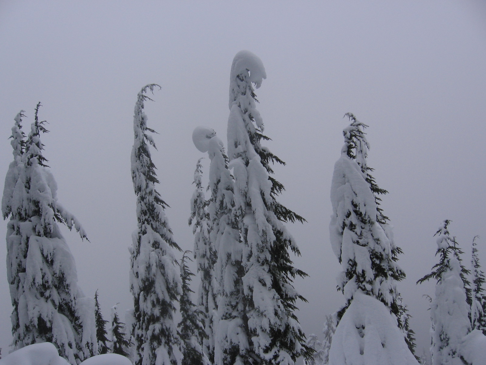
 After a while the trail leveled out, and after a little while longer, we were pretty sure we were at the edge of a ridge overlooking the lake. It was so overcast, that we couldn't see any of the views that the hike had listed as landmarks. We explored along the ridge for a while, playing in the deeper drifts, and then headed back down.